Tcp PointCloud Editor 1.8
Tcp PointCloud Editor 1.8
Enhance your point cloud projects
About Tcp PointCloud Editor
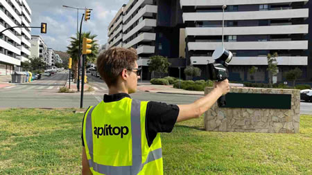
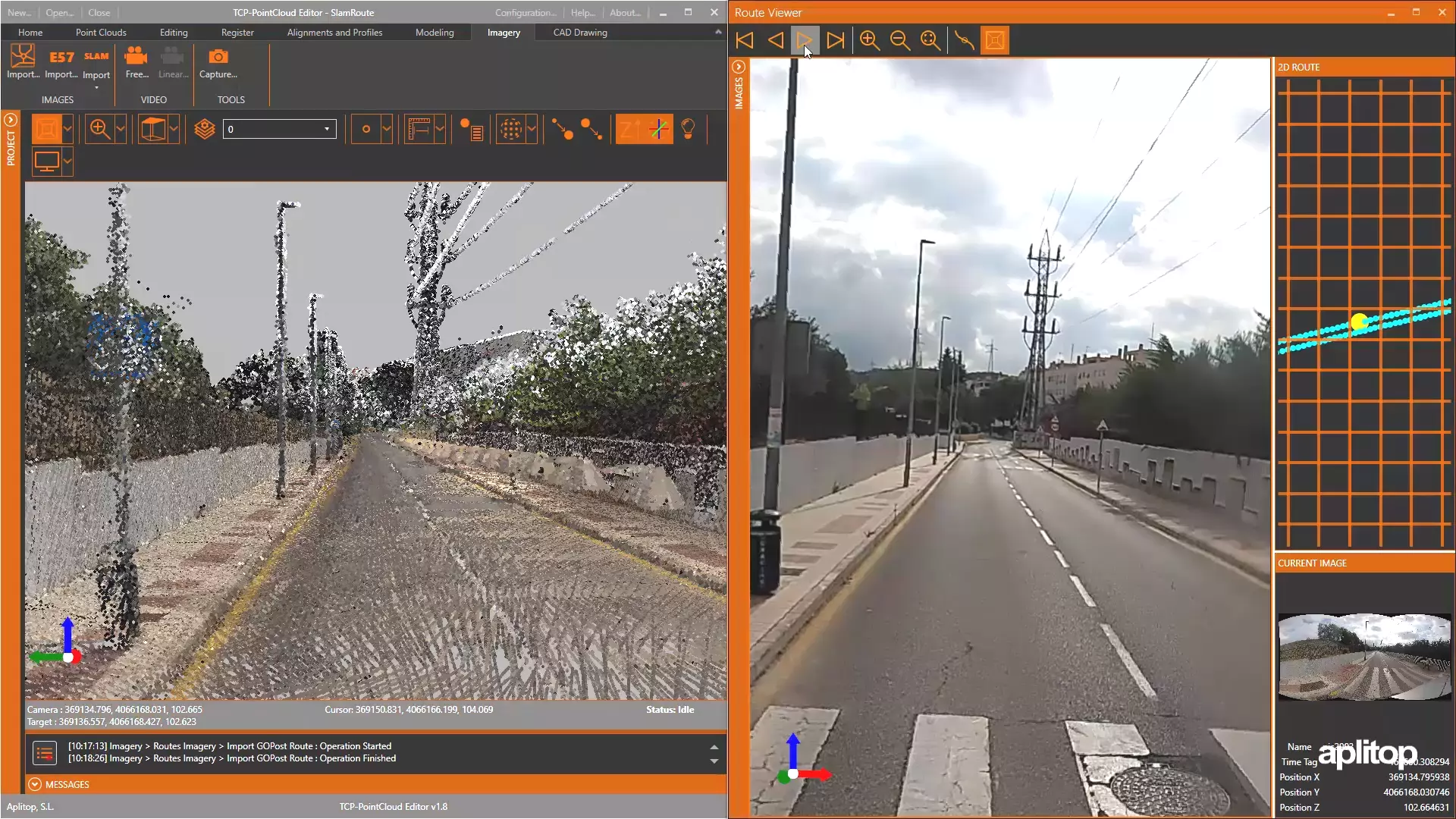
Introducing the latest version of our standalone application, designed to help you visualize, edit, and analyze point clouds and images from SLAM and stationary scanners, LiDAR sensors, or photogrammetry applications.
Aplitop's expertise meets SLAM technology, delivering an innovative solution that satisfies to the evolving needs of professionals, enhancing their workflow efficiency.
What's more, our solution is highly competitive in terms of pricing, making it a smart choice for your projects. Discover how it can empower your projects today!
What’s new in version 1.8?
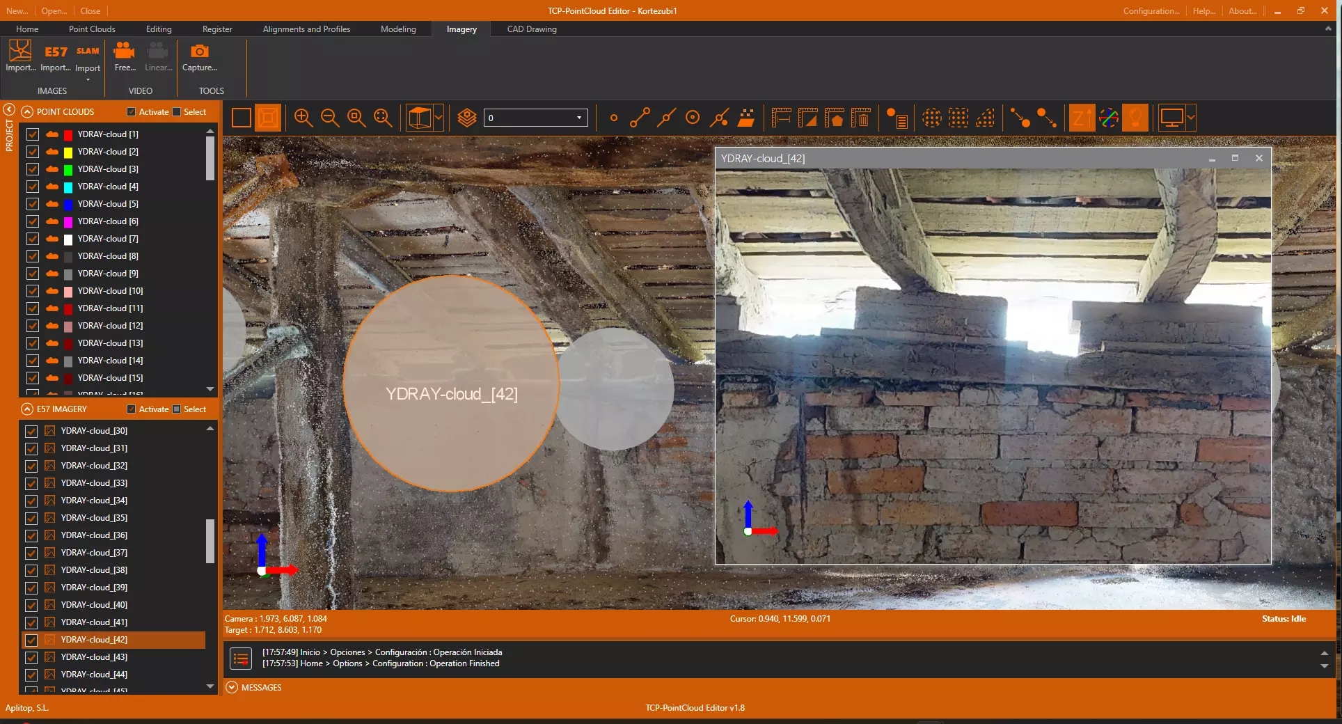
- SLAM scanner images and trajectory viewer
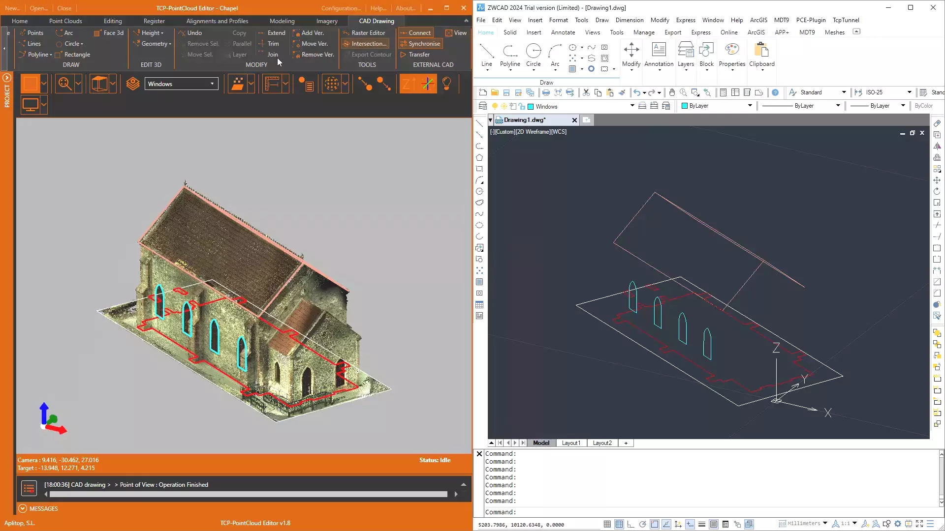
- Synchronization and bidirectional transfer of drawing entities with CAD
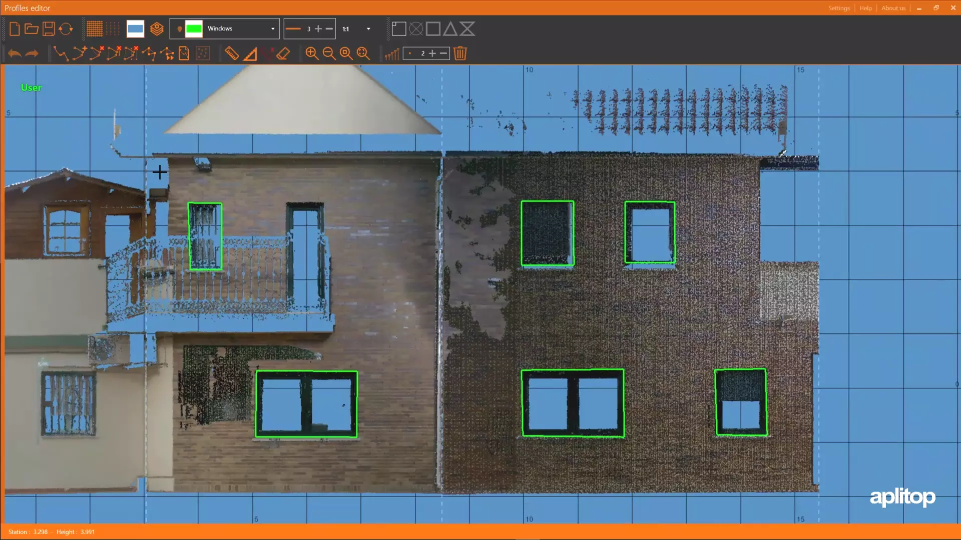
- Automatic vectorization on plan sections
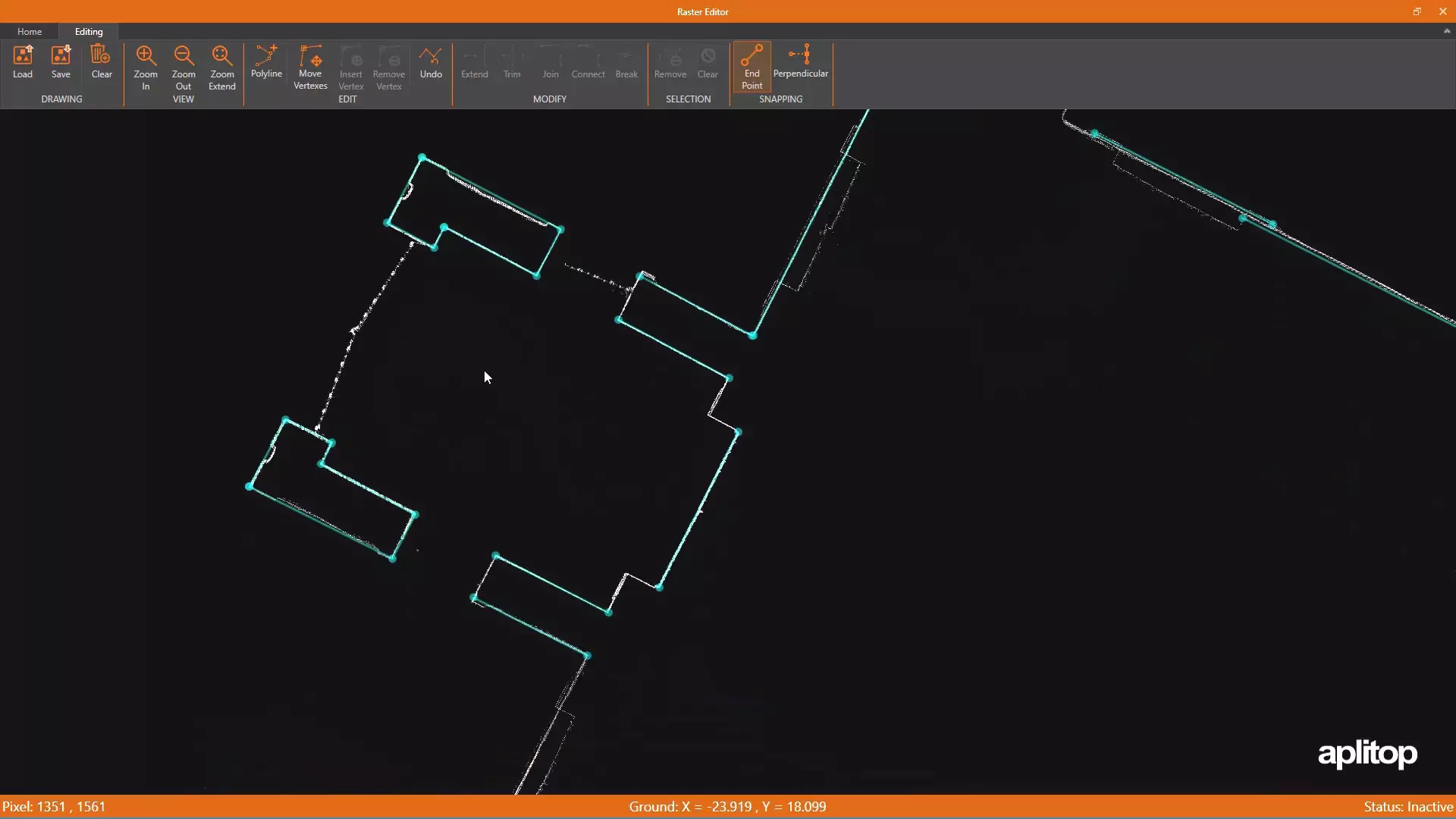
- Automatic creation of 3D polylines from the drawing made in the profile editor
- 360º image viewer from E57 files


Discover Our Users’ Voices
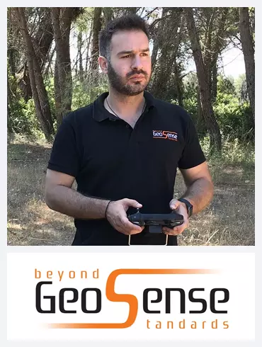
I used Tcp PointCloud Editor for geospatial analysis projects, processing LiDAR data to create detailed terrain models. The software’s user-friendly interface, support for various file formats, and powerful filtering and segmentation tools made it easy to use. The registration feature was helpful for aligning multiple scans. Overall, my experience was positive.
GEOSENSE (Greece)
Christos Gkotsikas
Geocom S.A. has collaborated with Aplitop to introduce their TCP PointCloud Editor in Chile. The software has made it easier for our clients to work with various point clouds, offering capabilities for importing, viewing, editing, and exporting. Its intuitive learning curve has led to its quick integration into our clients’ workflows. Overall, the tool has exceeded users’ expectations in terms of cost and functionality.
GEOCOM (Chile)
Pablo Ortega
If you want to import point clouds, analyze them, manipulate them, extract or convert data from them, draw certain conclusions from them, and of course reduce your processing time, then Tcp Point Cloud Editor is the right solution for you.
ARC GEO (Croatia)
Roberto Bravar. Owner
We decided to use Aplitop TCP PointCloud software in several building and cave scanning projects. The use of its tools has always been very comfortable to use when making quick sections of the model, digitizing, creating reference planes and especially very useful in the union of NdP and subsequent georeferencing. But what we most emphasize about working with Aplitop is their technical assistance, where we collect the needs we have and implement them as an improvement in the software. We are very satisfied.
EGEOMAPPING (Spain)
Marta Criado Valdés. Executive director
European Regional Development Fund.
APLITOP S.L. has been a beneficiary of the European Regional Development Fund whose objective is to improve the use and quality of information and communication technologies and access to them and thanks to which it has optimized our commercial processes for the improvement of competitiveness and productivity of the company 2022. For this, it has had the support of the INNOCAMARA PROGRAM of the Chamber of Commerce of Malaga. "A way of making Europe".
Funded by the European Union NextGenerationEU.
APLITOP S.L. has benefited from the INTERNATIONAL MENTORING Programme to improve and consolidate its international positioning through the implementation of an International Action Plan. The programme is financed by European Next Generation-EU funds, as part of the Recovery, Transformation and Resilience Plan.
Compromiso con el Medio Ambiente
Midiendo el futuro con sostenibilidad. Implementamos medidas responsables para reducir las emisiones de CO₂ el desarrollo de nuestras soluciones