Discover our CAD solutions that allow from modeling the terrain of small plots to more ambitious projects such as housing developments and photovoltaic plants.
Discover the different modules of tcpMDT
tcpMDT Standard
Surveys, digital terrain model, contour lines, profiles and volumes.
It allows terrain modeling using data obtained from total stations, GNSS receivers and importing files. It has options for generating contour lines, drawing longitudinal and transverse profiles, volume calculation, 3D visualization, slope maps, GIS import and export, etc. It contains commands for working with plots and multiple additional utilities.
tcpMDT Professional
Solution for Surveying, Civil Engineering, Architecture and Construction projects.
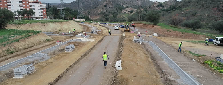
It includes all the features of the standard version and provides tools for the design of horizontal and vertical alignments, drawing of typical project sections, area and volume reports, stakeout, virtual walkthrough, measurements and budgets, etc. This application is suitable for all types of topographic projects for roads, urbanizations, quarries, etc. It is easily integrated into OpenBIM workflows, with IFC, LandXML, etc. file exchange.
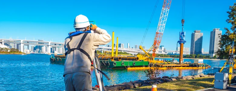
tcpMDT Surveying
Coordinate transformations and calculations with total station data.
Oriented to the calculation of point coordinates and compensation of polygonals and networks and to the processing of total station observations. It also allows to perform coordinate transformations with global coverage of reference systems, organized by countries.

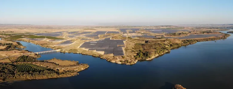
tcpMDT Photovoltaic
Optimization of topographic projects in photovoltaic installations.
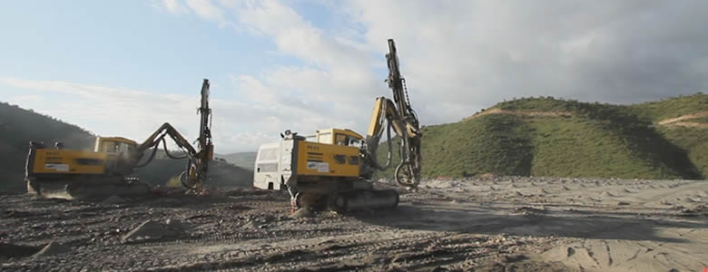
CAD application for the minimization of earthworks, measurements and stakeout of solar trackers. The workflow covers from terrain analysis, installation design, calculation and optimization to the production of results reports.
tcpMDT Standard and Professional: Which is right for you?
| Feature | TcpMDT Standard | TcpMDT Professional |
|---|---|---|
| AI assistant and MCP server: control the program using natural language | ||
| Import points and point clouds from total stations, GNSS receivers and drones | ||
| Automatic drawing from field codes with TcpGPS integration | ||
| Digital Terrain Model: TIN surfaces, meshes and LAS/LAZ file import | ||
| Contour lines: automatic generation, smoothing and labeling | ||
| Longitudinal and cross sections with configurable bands | ||
| Parcels: GML import and export, with subdivision, aggregation and reports | ||
| GIS data import and editing: Shape, GeoPackage, KML and WMS/WMTS services | ||
| 3D visualization, slope maps and virtual walkthrough | ||
| Horizontal and vertical alignment design with automatic vertical alignment | ||
| Typical sections: platforms, ditches, slopes and pavement layers | ||
| Earthworks: grading, cut, fill and geological volume calculations | ||
| Water, sewerage and stormwater networks in plan, profile and cross section | ||
| Stakeout and construction progress tracking: points, alignments, pavement layers and deviation analysis | ||
| BIM / OpenBIM with IFC 4.3: object classifications and property sets (Psets) |
Frequently Asked Questions about tcpMDT
tcpMDT is an ideal solution for a wide range of users in different industries, from surveyors and civil engineers to architects and construction professionals. Its ease of use, variety of tools and price make it a powerful and economical alternative to meet the challenges of these types of projects.
tcpMDT offers a number of benefits, including an easy learning curve, compatibility with all major CAD vendors, interoperability with DWG files and open BIM and GIS formats, modules tailored to the needs of professionals, high-level technical support, a wide range of learning resources from manuals to video tutorials, an active and growing user community around the world.
We offer both permanent licences and annual subscriptions.
Annual licences are for those users who want to keep their licence up to date and also include the maintenance service, which gives access to personalised technical support, updates and covers compatibility with the different CAD versions released during the year.
Permanent licences are not renewed and the maintenance service is offered separately. If you want to work with the latest CAD versions, you need to purchase the upgrade.
Our software is compatible with the main CAD software on the market: AutoCAD®, BricsCAD®, GstarCAD®, progeCAD® or ZWCAD®.
Not only the latest versions are supported, but also older versions. See the datasheet for more details.
In Aplitop, we offer two types of licenses: SINGLE SEAT license and NETWORK license.
The SINGLE SEAT license can be used on a single computer, so if you want to use it on another computer you need to transfer the license.
In NETWORK licenses, the software can be installed on any computer and connects to a server to check the availability of licenses. Network licensing requires the protection to be installed on a server in the same local area.
We can help you
Need help? Click on the following button to contact us and we will be happy to assist you.
Related products
tcp PointCloud Editor
AI-powered point cloud software for surveying, engineering, architecture and design
European Regional Development Fund.
APLITOP S.L. has been a beneficiary of the European Regional Development Fund whose objective is to improve the use and quality of information and communication technologies and access to them and thanks to which it has optimized our commercial processes for the improvement of competitiveness and productivity of the company 2022. For this, it has had the support of the INNOCAMARA PROGRAM of the Chamber of Commerce of Malaga. "A way of making Europe".
Funded by the European Union NextGenerationEU.
APLITOP S.L. has benefited from the INTERNATIONAL MENTORING Programme to improve and consolidate its international positioning through the implementation of an International Action Plan. The programme is financed by European Next Generation-EU funds, as part of the Recovery, Transformation and Resilience Plan.
Compromiso con el Medio Ambiente
Midiendo el futuro con sostenibilidad. Implementamos medidas responsables para reducir las emisiones de CO₂ el desarrollo de nuestras soluciones