Matulji, Croatia
| Company: | Geo-Stil d.o.o.GEODETSKE USLUGE |
| Web: | www.facebook.com/GEOSTILdoo |
| E-mail: | [email protected] |
| Location: | Matulji (Croatia) |
| Name: | Zoran Korlević |
| Position: | Land Surveyor |
| Main activities: | Geo-Stil is an authorized geodetic company based in Matulji, which carries out all kind of geodetic services and operates throughout the Republic of Croatia. |
| Dealer: | ArcGeo |
| Web: | www.arcgeo.hr |
Use Case
In a camping site near Rovinij (Croatia), a great deal of work had to be taken, which almost 90% of the camping site changed completely. The problem was not the surveying of the new camping site for the surveying office that I work for, but the calculation of the volumes of earthworks for the contractor company.
The data we were dealing with were our surveying data of the new camping site and .dwg form the surveying company who surveyed the area before this huge changing.
As we already have MDT in our company, the volumes calculation is not a big problem when we have the old and new situation from our measured data, from which is very easy to make DMRs.
In this case, however we didn’t have the measured data but only the situation of the camping site in the dwg file with points and height like text near the measured point. To make DMR from such data it would be very long since we should “click” almost 16k points (if not having MDT) and manually add the height attribute value to each point.
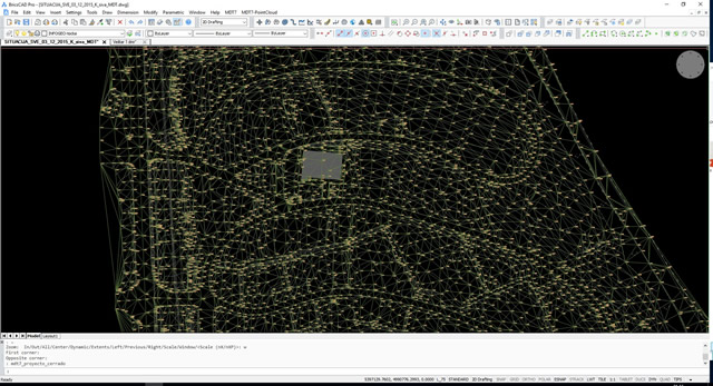
But with MDT there is no need for clicking, I had to convert just the drawing objects to MDT Points and I had all the 16k points in the database and ready to make DMRs and ever easier to calculate the volumes.
The procedure to convert drawing objects to MDT Points is simple: MDT > Points > Convert > Drawing Objects. Two more clicks for selecting the layer for points and height, click OK and pufff the points are here!
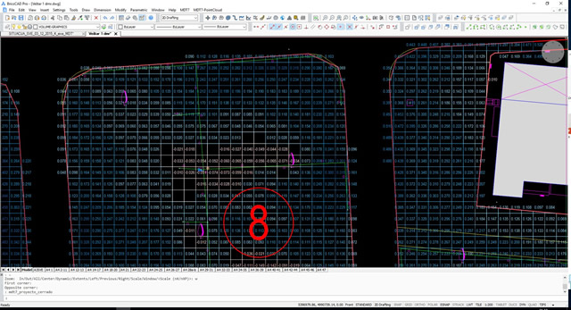
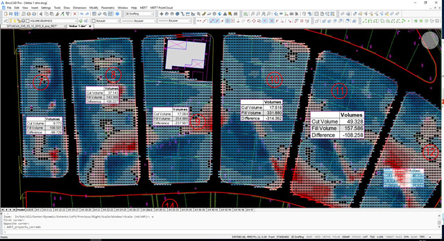
We have quickly created the existing surface from a drawing with only 2D points and elevation labels, and then compared it with the project surface to get a map and report of cut and fill volumes. All has been done in a very easy way!
