Urban Environment Scanning and Analysis in Anyang, China
| Company: | GoSLAM |
| Location: | Anyang, China |
| Website: | en.goslam.com |
| Main Activity: | Development of mobile LiDAR and 3D scanning solutions for accurate and efficient spatial data acquisition |
Use Case
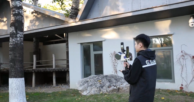
The project consisted of scanning and analyzing an urban environment in the city of Anyang (Henan province, China), with the need to capture large volumes of data quickly and efficiently.
The main challenges were the speed of field acquisition, managing a high-density point cloud, noise removal, automatic element classification, and generating final models and results oriented to surveying and engineering work.

Point cloud of the urban environment captured with GoSLAM M40 RTK
The solution was based on combining the GoSLAM M40 RTK mobile scanner with Aplitop's tcp Point Cloud Editor software, covering the entire workflow from capture to final analysis.
The scanning process was fast and simple, controlled from a mobile device, generating a post-processed point cloud of approximately 181 million points. This cloud was imported into tcp Point Cloud Editor, where it could be viewed by natural color, elevation, intensity, or time.

Point cloud visualization by different attributes
Using advanced editing tools, noise points were removed and elevation filters were applied to temporarily hide vegetation. Automatic classification based on artificial intelligence assigned categories such as terrain, vegetation, buildings, or vehicles, greatly facilitating the analysis.

Automatic classification using artificial intelligence
The software allowed generating digital terrain models, contour lines, profiles, as well as performing 2D and 3D measurements with great precision. CAD tools facilitated drawing directly on the point cloud, layer management, and object editing.

DTM generation, contour lines, and CAD tools
Additionally, panoramic images were integrated by synchronizing the view with the point cloud for better spatial understanding. Finally, the results were exported to a web viewer, allowing visualization and analysis from any device.

- Very fast and efficient field data capture
- Management of large point clouds (more than 180 million points)
- Automatic classification using artificial intelligence
- Significant time savings in processing and analysis
- Integrated tools for DTM, measurements, CAD, and visualization
- Easy sharing of results via web viewer

Web publishing for visualization and analysis from any device
European Regional Development Fund.
APLITOP S.L. has been a beneficiary of the European Regional Development Fund whose objective is to improve the use and quality of information and communication technologies and access to them and thanks to which it has optimized our commercial processes for the improvement of competitiveness and productivity of the company 2022. For this, it has had the support of the INNOCAMARA PROGRAM of the Chamber of Commerce of Malaga. "A way of making Europe".
Funded by the European Union NextGenerationEU.
APLITOP S.L. has benefited from the INTERNATIONAL MENTORING Programme to improve and consolidate its international positioning through the implementation of an International Action Plan. The programme is financed by European Next Generation-EU funds, as part of the Recovery, Transformation and Resilience Plan.
Compromiso con el Medio Ambiente
Midiendo el futuro con sostenibilidad. Implementamos medidas responsables para reducir las emisiones de CO₂ el desarrollo de nuestras soluciones