Design and development of BIM technologies for validation and management of road construction projects, their exploitation and the safety management of these road infrastructures.
RoadBIM
Design and development of BIM technologies for validation and management of road construction projects, their exploitation and the safety management of these road infrastructures.
| Code: | ITC-20161077 |
| Program: | FEDER INNTERCONECTA. Convocatoria 2016 |
| Start date: | October 2016 |
| End date: | December 2018 |

Financing
El presente proyecto ha sido desarrollado con la colaboración económica del Fondo Europeo de Desarrollo Regional (FEDER), a través del “Programa Operativo de Crecimiento Inteligente 2014-2020” y el Ministerio de Economía y Competitividad, a través del Centro para el Desarrollo Tecnológico Industrial (CDTI).

Links
- APLITOP, primera empresa en el mundo que implementa el formato IFC Alignment
- APLITOP en el grupo de trabajo IFC Road para BIM aplicado a carreteras
- APLITOP participa en el congreso sobre estándares de buildingSMART Internacional
- Línea de investigación BIM
- Web del proyecto ROADBIM
- Grupo de trabajo de infraestructuras de buildingSMART
- buildingSMART España
Objectives
The Design and development of BIM technologies for validation and management of road construction projects, their exploitation and the safety management of these road infrastructures project (ROAD-BIM) has the general objective of achieving a more efficient development of road construction projects throughout its useful life through the application of BIM technology in the management processes of the information required for its implementation.
This objective will be achieved through the design, development and validation of various specific computer applications for use in the various stages of the road life cycle (design, construction and exploitation), taking advantage of the potential and the possibilities that BIM technology offers, thus achieving a more efficient management of the information necessary for the integral development of this type of project.
Investigation Results
The IFC Alignment project has created common definitions for horizontal and vertical alignments that are used in linear works projects, such as roads, railways and tunnels. APLITOP, as a partner of the ROADBIM consortium, has been involved in the implementation of the software in this format, since it is fully aligned with the project's objectives.
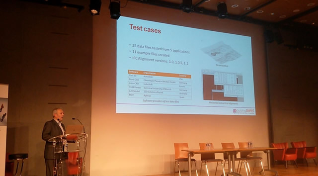
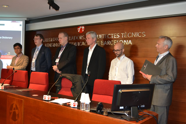
In March 2017 we were invited to perform a live demonstration at the Standards Summit in Barcelona, being the first commercial application in the world being able to import and export in this format.
We have subsequently worked with international teams in file sharing between different applications, and in March 2018 APLITOP was invited to the Standards Summit held in Paris to share their experience as a software developer.

This project, managed by the infrastructure working group, buildingSMART International, aims to develop an extension of the IFC standard so that it can be used to exchange data on road projects in any country.
The participants are: Korea Institute of Civil Engineering and Building Technology (KICT), APLITOP, APOGEA, China Railway BIM Alliance (CRBIM), Federal Ministry of Transport and Digital Infrastructure (BMVI), FTA (Finnish Transport Agency), Swedish Transport Administration, Autodesk and MinD.
APOGEA is actively participating in phase 1 which consists of analysing requirements, use cases and format definition, while APLITOP will have greater participation in phase 2, especially in software implementation.

This application allows you to upload files in IFC Alignment or IFC Road format for a road project. It has a 3D view that allows you to examine the project with all its elements, and you can also activate specific views to visualise the ground and elevation axes, superelevation and curvature diagram, cross sections, etc.
A viewer for Virtual Reality has also been developed that works with Oculus Rift, which achieves a high degree of realism, with textures assigned to the ground and road, with the ability to modify the intensity of sunlight, and simulate atmospheric phenomena such as rain, wind, fog, etc.

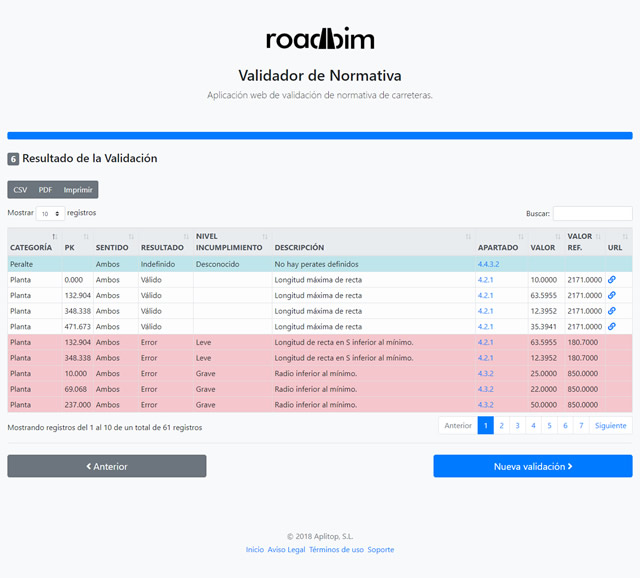
The BIM project validator allows you to open a file in IFC format, select one of the alignments and the applicable regulations. After confirming or entering general and specific data, the validation process is executed and you can activate or deactivate horizontal and vertical checks, plant-elevation coordination, cross section and visibility distance.
The results of the validation are shown in the form of a table containing the category, chainage, direction of traffic, result (valid, warning or error), level of non-compliance (minor, intermediate or serious), description, section on standards and reference and current values. You can also add observations to justify exceptions, as well as search and filter results by different criteria. The report can be printed and exported to DOC and PDF formats.


