Indoor Survey and 3D Modeling of a Train Station near Milan, Italy
| Company: | Stonex |
| Location: | Milan (Italy) |
| Website: | https://www.stonex.it/ |
| Name: | Stonex Team |
| Position: | Technical Surveying Team |
| Main Activity: | Development of surveying technologies and solutions |
Use Case
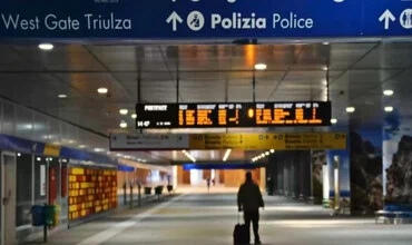
This project focused on an indoor study of a train station located near Milan, close to Stonex's main offices. The objective was to capture the entire interior of the station and demonstrate how to integrate panoramic images and LiDAR data into a detailed 3D model for visualization, measurement, and vectorization.
The main challenge involved completely documenting the complex interior space of the station, including stairs, vending machines, and railway platforms, using advanced scanning technology. A solution was required that would allow not only capturing the precise geometry of the space, but also integrating panoramic images to facilitate virtual navigation and detailed analysis.

Verification of panoramic image properties captured during indoor scanning.
A single 20-minute scan was performed in the large interior space of the station using a Stonex X70 GO SLAM scanner combined with a panoramic camera, achieving an impressive global accuracy of around 2 cm. The scanner enabled the generation of 360-degree images that were automatically synchronized with the scanning data.
The collected E57 file contained both point cloud data and panoramic images. Once imported into tcp PointCloud Editor, the software automatically linked the images to their corresponding scan positions, allowing seamless navigation between panoramas and 3D views.

Management and assignment of geotags to organize scan data.
Users could enter the station virtually, clicking through scan bubbles to inspect the interior. tcp PointCloud Editor enabled direct measurements on panoramic images thanks to synchronization with the underlying point cloud, and users could draw vectors directly on images and visualize them in 3D.

Measurement and vector drawing tools directly on panoramic images.
For detailed modeling, horizontal cuts were extracted from the point cloud using coplanar sections at regular height intervals, isolating structural elements such as walls and columns. In a second phase, the staircase was modeled using rapid profiles and 3D extrusion tools, creating a precise reconstruction in three-dimensional space.

Extraction of coplanar cuts for structural element analysis.

Staircase reconstructed with precision in 3D space using extrusion tools.

- The project demonstrated how tcp PointCloud Editor optimizes the workflow from raw LiDAR data and panoramic images to complete 3D modeling.
- Integration of images and scans significantly enhanced navigation and inspection capabilities of the interior space.
- Advanced vectorization tools enabled precise reconstruction of structural elements with centimetric accuracy.
- Intuitive measurement and modeling functions reduced post-processing time and provided valuable results for documentation and BIM integration.
- In a single 20-minute scan and a few processing steps, the entire train station interior was transformed into a navigable and editable 3D model.
European Regional Development Fund.
APLITOP S.L. has been a beneficiary of the European Regional Development Fund whose objective is to improve the use and quality of information and communication technologies and access to them and thanks to which it has optimized our commercial processes for the improvement of competitiveness and productivity of the company 2022. For this, it has had the support of the INNOCAMARA PROGRAM of the Chamber of Commerce of Malaga. "A way of making Europe".
Funded by the European Union NextGenerationEU.
APLITOP S.L. has benefited from the INTERNATIONAL MENTORING Programme to improve and consolidate its international positioning through the implementation of an International Action Plan. The programme is financed by European Next Generation-EU funds, as part of the Recovery, Transformation and Resilience Plan.
Compromiso con el Medio Ambiente
Midiendo el futuro con sostenibilidad. Implementamos medidas responsables para reducir las emisiones de CO₂ el desarrollo de nuestras soluciones