Andhra Pradesh, India

| Company: | Department Of Land Revenue [ SSLRD ] |
| Location: | Andhra Pradesh (India) |
| Dealer: | APOGEE GNSS |
| Web: | www.apogeegnss.com/ |
| Name: | Tanuj Bartar |
| Position: | Director |
| E-mail: | [email protected] |
| Main activities: | APOGEE GNSS is the leading provider of positioning technologies and has a history of inventing innovative solutions which act as import substitutes. From manufacturing India’s first domestically developed GNSS receiver with large scale deployment, APOGEEs’ hardware and software solutions are revolutionizing many industries in India such as agriculture, construction , geospatial, surveying & engineering. |
Use Case
The Revenue Department has drawn up an action plan for a comprehensive re-survey of lands across the state. It has prepared a report with elements on how to do this massive program that it wants to undertake for the first time in nearly 120 years.
There are 17,460 revenue villages in the state, which include 90 lakh pattas while 2.26 crore acres of land belonging to pattadara under 1.96 crore survey numbers is to be re-surveyed. The Revenue Department has prepared an action plan to complete the comprehensive re-survey process of lands in 5,000 villages in all mandals of the state in the first phase, 6,500 villages in the second phase and 5,500 villages in the third phase.

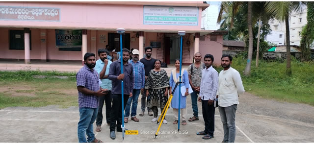
A survey team of two Village Surveyors and Village Revenue Assistant (VRA) will be formed for each village. It has basically decided to set up 4,500 teams across the state. Re-survey of records is not possible without purification. Therefore, a team with two Village Revenue Officers (VROs) will be set up for each village to examine the land records. There will be a system where the tehsildar will review and approve the land register approved by a team of VROs.
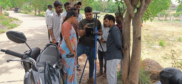
APOGEE has supplied more than 300 units of Navik 200 and 250 units of Navik 50 advanced RTK GNSS receivers with millimeter accuracy. They were governed by TcpGPS application powered by Aplitop.
The software is a feature-rich application designed for Android devices that focuses on providing comprehensive GPS surveying functionality. Its main features include real-time GPS data acquisition, accurate positioning, and the ability to handle different coordinate systems and geodetic datums. The software allows users to import/export data in popular formats, enabling seamless integration with other tools and systems. With its user-friendly interface, TcpGPS Android enables easy navigation and data visualization on maps, making it suitable for a wide range of surveying and mapping tasks. Additionally, the software supports data synchronization with remote servers, ensuring efficient collaboration and data management.

Overall, TcpGPS Android serves as a powerful and flexible tool for professionals in the surveying and geospatial industry, enhancing their productivity and accuracy in the field.
Surveyors working on this project are liking that the application is easy to learn and takes care of almost all requirements that they require in Land Parcel demarcation and survey.


