From the Aplitop team, we announce a series of new features, fixes and improvements.
What are the latest features?
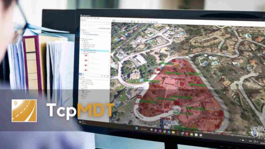
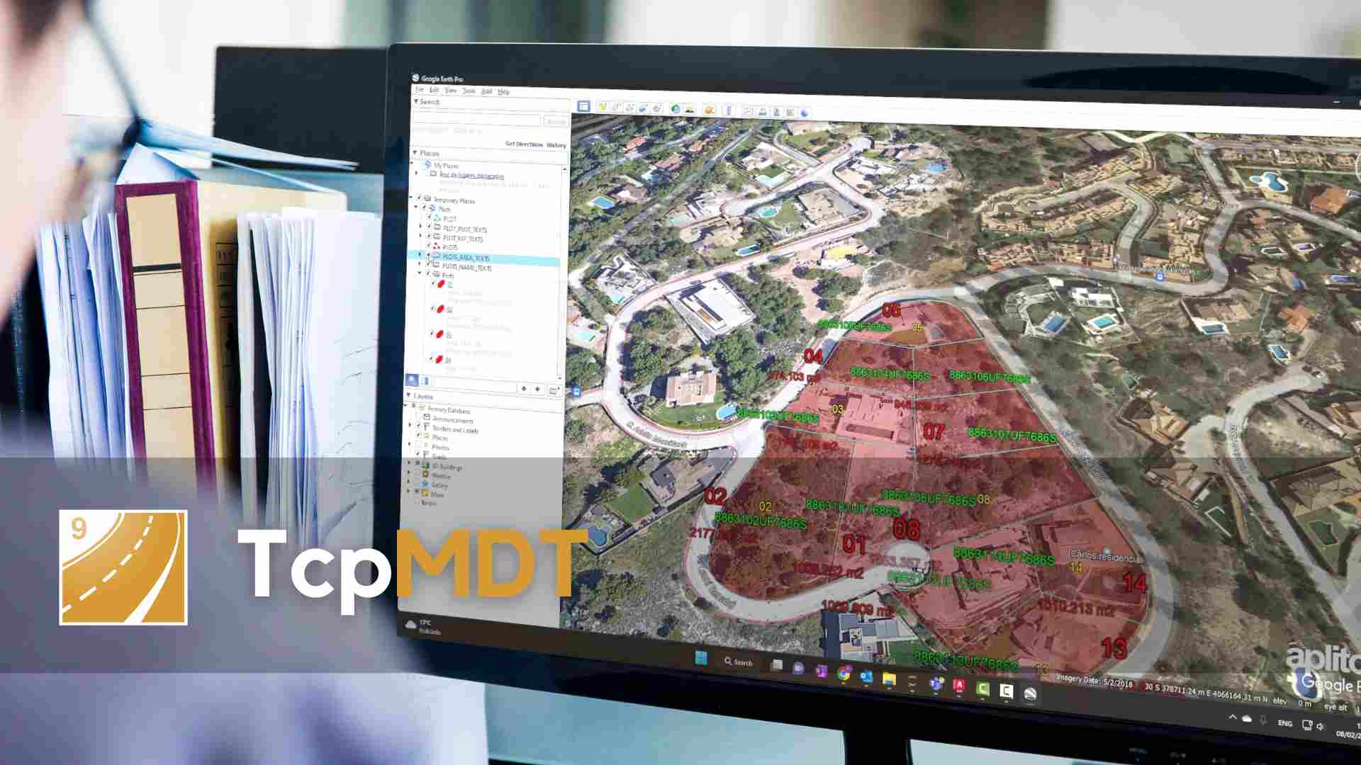
🆕 In the export to KML for Google Earth, texts are now included and you can decide whether the altitudes are absolute or glued to the ground. (Vídeo)
🆕 Direct export to PDF format from the profile editors.
🆕 Section editor allows to update the segment and to continue working in the CAD
🆕 New command to send current project information and files.
🆕 When importing shapefiles you can select the source and destination systems, reprojecting if necessary.
What new enhancements have been implemented?
✅ It is now possible to assign different diameters to a pipe section (add to video library).
✅ In the calculation of volumes by mesh difference it is now possible to compare files with different cell size.
✅ Separation of platforms, ditches and slopes in the Hexagon XML export of the selected instrument.
For more information, you can access the change history document.