
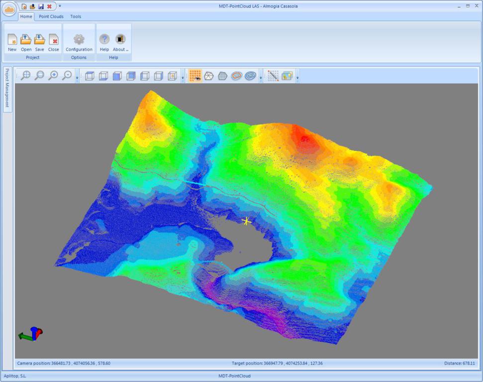
Announcing the release of MDT Point Cloud, a new module that enables the users to view and process point clouds created by LIDAR technology or conventional scanners.
Points can be viewed in natural colour, intensity or category. The amount percentage of points to be displayed and the pixel size of the points can be controlled.
The quick profile option enables the users to get an immediate view on the profile which is on a reference plane and generated from a polyline drawn on the screen. The program generates an image consisting of the projection of points selected within a distance.More accurate results can be obtained by drawing alignments or importing them from files and computing profiles and cross sections.
Once the points are selected, the digital model can be created, and the result can be viewed on the point cloud and also be stored as a surface or mesh. All can be sent to MDT with a single clic.
This module requires MDT version 6.5 with release date after 18/12/2012.
News
European Regional Development Fund.
APLITOP S.L. has been a beneficiary of the European Regional Development Fund whose objective is to improve the use and quality of information and communication technologies and access to them and thanks to which it has optimized our commercial processes for the improvement of competitiveness and productivity of the company 2022. For this, it has had the support of the INNOCAMARA PROGRAM of the Chamber of Commerce of Malaga. "A way of making Europe".
Funded by the European Union NextGenerationEU.
APLITOP S.L. has benefited from the INTERNATIONAL MENTORING Programme to improve and consolidate its international positioning through the implementation of an International Action Plan. The programme is financed by European Next Generation-EU funds, as part of the Recovery, Transformation and Resilience Plan.
Compromiso con el Medio Ambiente
Midiendo el futuro con sostenibilidad. Implementamos medidas responsables para reducir las emisiones de CO₂ el desarrollo de nuestras soluciones