Madrid, Spain

| Company: | eGeoMapping |
| Web: | www.egeomapping.com |
| Location: | Madrid (Spain) |
| Name: | Miguel Ángel Ruiz Tejada |
| Title: | Managing Director |
| E-mail: | [email protected] |
| Main activity: | Engineering and consulting, training and dissemination company, specialized in Geographic Intelligence. They offer comprehensive services linked to Geomatics, to meet the demand of individuals, public and private organizations that, in the development of their activity, are related to some geographical component. |
Use Case
It is increasingly common for architects and architecture companies to call us to request not only the 3D scanning of an environment in which they are going to do a performance, whether remodeling, rehabilitation or valuation of a property, but the metric virtual tour of it, since it is of utmost importance for our clients.
In addition to this advantage for them, for us in this first phase where we are going to make the plans even 2D, consult and clear doubts when vectorizing the plant avoids errors or errors of interpretation in that digitization of the point cloud of the scanner, or what we want to avoid, the call of the client saying "this does not fit me".

As important as a good work methodology that we have been acquiring with experience, is to have all the necessary tools to be able to tackle any project with sufficient guarantees to give the ideal and optimal product.
For the most common case of the preparation of 2D section plans of a property, the following steps have been carried out:
- Study of the area to be scanned, detecting areas of low lighting and narrow areas. White light bulbs, colored cones and Matterport targets were also placed.
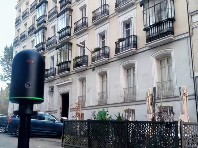
- Scanning with Matterport Pro3 and Leica BLK 360.
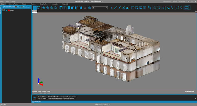
- Point cloud (PCL) generation with automatic correlation by Matterport's Cortex artificial intelligence or Leica Cyclone Register 360 software

Convinced that we have an optimal PCL generated in the previous phase, through digital files in ASCII XYZ or E57 format, it is time to draw. We assume that there are many commercial applications on the market, but for this phase we have chosen the software of the APLITOP company TCP POINTCLOUD EDITOR. This software gives us solution to the most important tasks to deliver a quality product:
- Alignment of PCL in different coordinate systems. Manually identifying homologous points in the different clouds or locating already georeferenced targets perfectly solves the homogeneity of the correlation of the PCL obtained.
- Coplanar sections at different elevations. The ease of generating different PCL sections on which to "paint" helps us locate the line of the wall that is not seen in one of the sections, but we have the following ones.
- Sections in height. In stairwells, for example, we make an inverse selection of the area to be vectorized and we get rid of everything that hinders the correct vectorization.
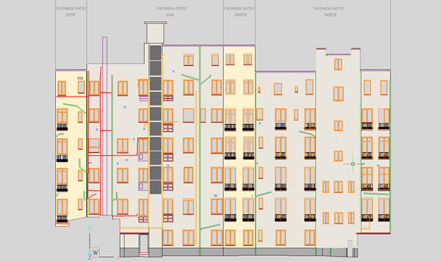
- Vectorization of facades and / or courtyards of buildings. Tcp PointCloud Editor has facilitated the digitization on the PCL of a façade by generating a plane through three points. Once that plane is defined, let's draw!
More information: www.egeomapping.com/trabajos-de-escaneado-3d-fase-i


