TcpScancyr
Point cloud analysis of road and rail tunnels.
About the product
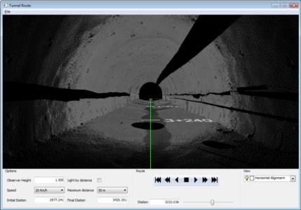
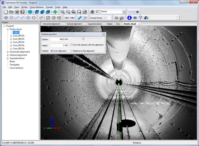
This powerful application calculates tunnel cross sections for roads or railways, based on laser scanner data.
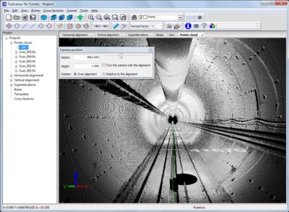
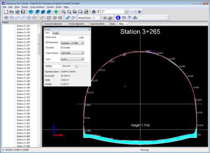
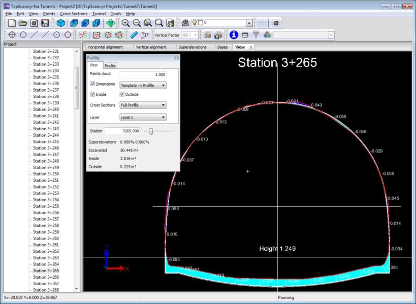
Starting from the point cloud, cross sections are calculated, which can be modified by a powerful editor. They can be displayed in 2D or 3D, showing the infra and over-excavation zones, and can also be exported to DXF, with multiple customization options.
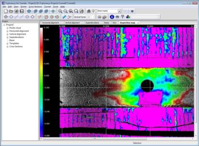
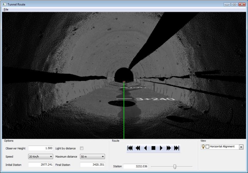
The program also generates other results such as area and volume reports, deviation of the real alignment, inspection map, orthoimages and video simulation of the tunnel.
Solutions by Industry
Explore how our applications are used in your sector or industry.
BIM
Our software facilitates the exchange of survey and civil project data using industry OpenBIM standards such as IFC and BCF.
Civil Engineering
Solutions that facilitate the development of road projects, railways, tunnels, dams, power lines, pipes and all types of civil works.
Quarries and Mining
We offer solutions to meet the needs of all types of quarry and mine operations, both open-pit and underground.
Related products


European Regional Development Fund.
APLITOP S.L. has been a beneficiary of the European Regional Development Fund whose objective is to improve the use and quality of information and communication technologies and access to them and thanks to which it has optimized our commercial processes for the improvement of competitiveness and productivity of the company 2022. For this, it has had the support of the INNOCAMARA PROGRAM of the Chamber of Commerce of Malaga. "A way of making Europe".