Aplitop | Land Surveying and Civil Engineering Software - list-news

aplitop-spinning

News

2021
Introducing MDT for ZWCAD 2022

Introducing MDT for ZWCAD 2022

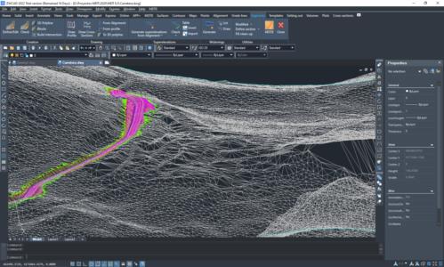
Announcing the availability of MDT 8.5 for ZWCAD 2022, among whose novelties we can highlight:- Coexistence of classic menu and ribbon menu, now compatible with MDT- Direct import of IFC files- Create a planar projection of the outline of a 3D entity- New measurement of geometry and physical properties of objects- Data extraction improvementsThis u ...

2021
TOPCON and APLITOP sign a liaison for the tunneling market

TOPCON and APLITOP sign a liaison for the tunneling market

Málaga (Spain), 27 May 2021The intention of this liaison is the collaboration of Aplitop with Topcon’s distribution network to identify suitable projects and promote the use of Topcon GTL-1000 into them.Based on TOPCON technology in robotic total stations and terrestrial scanners, APLITOP has developed TcpTUNNEL Scan, an application fo ...

2021
Collaboration with the LEICA GEOSYSTEMS CPE

Collaboration with the LEICA GEOSYSTEMS CPE

We are proud to announce our collaboration with the Leica Geosystems CPEC.Now maximum efficiency can be achieved with a Leica Geosystems CPE certified reconditioned equipment and Aplitop software to have a complete solution. It is very easy to exchange data with a GNSS receiver or data controller and work on surveying projects, from modeling a plot ...

2021
New real-time control tunneling software

New real-time control tunneling software

APLITOP has developed TcpTUNNEL Scan, an application for the control of tunnel works in real time for the TOPCON scanning robotic total station.The software commands the scanning of the tunnel dome or face and show the point cloud in a powerful 3D viewer. High definition tunnel cross-sections are calculated, and they can be compared to the tunnel d ...

2021
TcpGPS 2.1 now available!

TcpGPS 2.1 now available!

Announcing TcpGPS for Android version 2. 1,  which includes more than 30 new options and enhancements, among which we can highlight the following:·         Even more brands of receivers and supported models·         Measuring by voice commands and flo ...

2021
MDT now works on GStarCAD!

MDT now works on GStarCAD!

We announce the compatibility of TcpMDT 8.5 with GStarCAD Professional  2021, offering users an interesting and cost-effective alternative solution to develop their surveying projects in CAD environment.GstarCAD is a CAD alternative with high compatibility with other platforms on the market. With nearly 30 years of continuous improvement and i ...

2021
Announcing the integration of TcpStereo with VOLFONI devices

Announcing the integration of TcpStereo with VOLFONI devices

TcpStereo allows stereoscopic restitution using aerial photographs with previously defined orientations, in an easy-to-use CAD environment. To achieve the maximum productivity, we recommend using Volfoni RF emitter and Volfoni EDGE active 3D glasses. Consult the product requirements for more details.This solution is especially useful for photo ...

2021
MDT for AutoCAD 2022 is here!

MDT for AutoCAD 2022 is here!

This update is free for all users with active subscription. You can get a full installation for all supported CAD versions from your private download area. In case you already have MDT8 or higher installed, you have to uninstall it first.Users of previous versions or without subscription can purchase an upgrade through their distributor.Advant ...

2021
Topcon Aplitop Online Webinars

Topcon Aplitop Online Webinars

You will see and experience the most productive workflow from Topcon and Aplitop when it comes to your Tunnel construction work. It’s a game-changer against your current workflow that you are applying to your projects right now.Robotic Total Station, Terrestrial Laser Scanner and Tunnel CAD: Field and Post Processing software will take y ...

2020
We Help You in the Field and the Office

We Help You in the Field and the Office

Achieve maximum efficiency with Aplitop TcpGPS + TcpMDT complete solution. The data measured in the field is shared in the cloud so that the points, lines and digital model are automatically drawn in the office, including the photos and voice notes. In addition, all designs created in the office can be transferred to the field directly in DWG, Land ...

Can we help you?