Aplitop | Land Surveying and Civil Engineering Software - list-news

aplitop-spinning

News

2014
APLITOP in INTERGEO 2014

APLITOP in INTERGEO 2014

INTERGEO is the world’s leading trade fair for geodesy, geoinformation and land management. This time will be in Berlin (Germany), from October 7th to 9th, and will have more than 500 exhibitors from 30 countries. APLITOP is continuing its international expansion plan, and will participate with its own booth (Hall 1.1, number E1.014), where will ...

2014
MDT 7 is here !

MDT 7 is here !

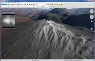
Announcing the release of MDT version 7, compatible with latest versions of more widely extended CAD engines (AutoCAD 2015, BricsCAD V.14 and ZWCAD+ 2014) and operating systems Windows XP, 7 and 8 in 32 and 64 bits. The main changes are the interactivity of application, with context sensitive menus and automatic update of drawing, the use of grids ...

2014
TcpGPS Lite for iOS

TcpGPS Lite for iOS

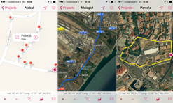
Announcing the release of this application, that allows the user to make surveys using integrated GPS with its nominal precision, in a fast and easy way. Just like the Android version, it can be used by surveyors and other technicians for surveys consisting on measuring lots, paths, crops, pipes, electrical lines, urban furniture… Maps are used a ...

2014
TcpTunnel 4.0.1

TcpTunnel 4.0.1

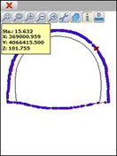
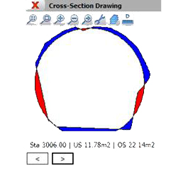
Suggestions from dealers and users have been taken into account to do the main features of this version. The following features have been added to the new release: - Within the cross-sections surveying, the program allows one to move the total station to the measured points, just tap on them graphically. Also, the program shows analytical data c ...

2014
New engine for TcpMDT-CAD

New engine for TcpMDT-CAD

TcpMDT-CAD is a software designed for those professionals looking for a tool for the development of Surveying and Civil Engineering projects without purchasing an expensive CAD license. With the same functionality as the MDT Professional and CAD included in a single installation, TcpMDT-CAD is ideal for working on projects such as land surveying, ...

2014
MDT for BricsCAD v14

MDT for BricsCAD v14

Announcing the compatibility of MDT with BricsCAD v14. This new release that develops breakthrough technologies such as:      - New licensing engine for stand-alone, network, and      - New commands for 2D drafting      - New graphical bar for navigating throu ...

2013
The release of TcpTunnel v4.0

The release of TcpTunnel v4.0

Announcing the release of the new versions of our applications for setting out, survey and data processing in tunnels with total station. TcpTunnel v4.0, for total stations or compatible data collector, adds the following new features:   •  New models of total station supported: Spectra, Geomax, Leica, Topcon, Sokkia and others ...

2013
TcpGPS Lite for Android

TcpGPS Lite for Android

This application, installed on a mobile device with Android operating system, allows the user to make surveys using integrated GPS with its nominal precision, in a fast and easy way. It can be used by surveyors and other technicians for surveys consisting on measuring lots, paths, crops, pipes, electrical lines, urban furniture... Google MapsTM i ...

2013
MDT for ZWCAD+ 2014

MDT for ZWCAD+ 2014

Announcing the compatibility of MDT with ZWCAD+ 2014.   This new release that develops breakthrough technologies such as: - Support for DWG/DXF 2013 and DWF files - Memory optimization that allows working with drawings over 100 Mb - New image processing engine - Dynamic blocks - Online module for file sync and mobile design  In a ...

2013
MDT for AutoCAD 2014

MDT for AutoCAD 2014

We announce the availability of MDT for AutoCAD 2014 for users with maintenance contracts or licenses purchased or updated from 13/02/2013. The support for this version will be supplied with new orders together with other CAD platforms. In a few days, all users with current maintenance contract will be able to download the upgrade from their pri ...

Can we help you?