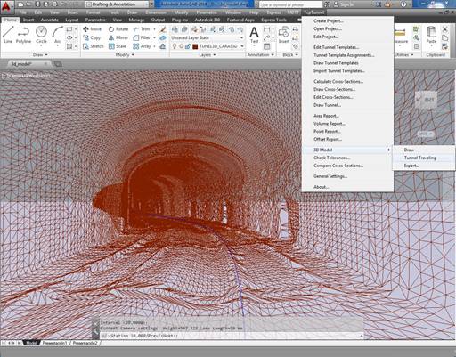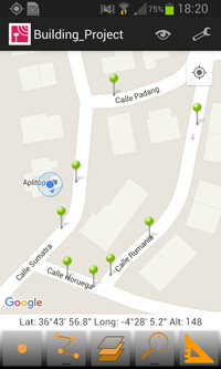
Another step of APLITOP on ANDROID development
APLITOP has added new functions to its TcpGPS Lite software for mobile devices with Android operating system, for rapid surveys using the integrated GPS of your mobile phone or tablet with its nominal precision, very easily.As basemap Google MapsTM is used, being able to switch between the standard mode, satellite, hybrid and terrain. At all times ...